Find out how to submit feedback, concerns, or questions from the map →
Overview
The Conservation Incentive Toolkit at https://map.wrmcalliance.com is designed to identify opportunities for land conservation in the communities that neighbor Crane and Lake Glendora.
The toolkit includes an interactive web-based map that informs landowners and partners about conservation programs for agriculture parcels, and also provides an avenue for the public to connect directly with the WRMCA with questions and concerns.
It includes tools targeted for Landowners, Conservation Partners, and the public.
Landowners can find potential conservations programs for their agriculture parcels.
Partners can use the conservation index to plan conservation activities in the area.
Anyone can submit feedback, concerns, or questions from the map.
Use the zoom tools at right to zoom in and out on the map. Click and drag on the map to pan or move around.
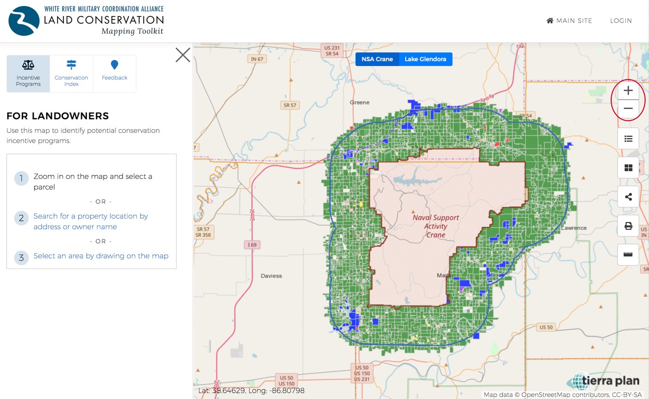
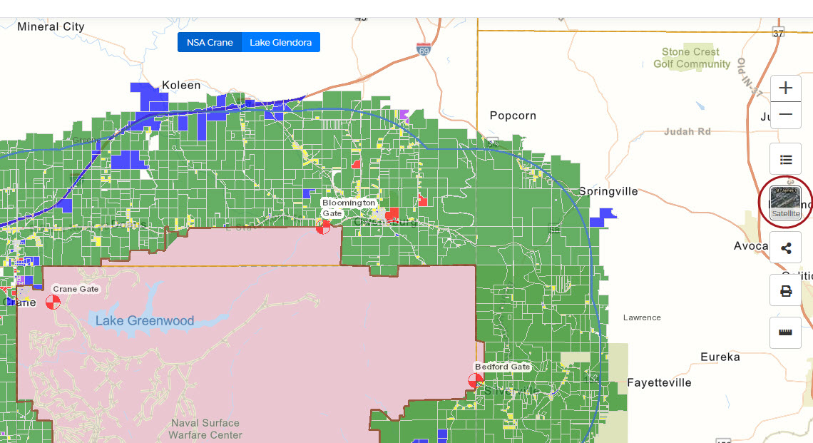
Layers
Click on the layers button at right to see available map layers in the left panel. Turn on and off layers including for the installation boundaries, 3-mile buffers, Military Compatible Areas, flood plains, wetlands, habitats, and more
Basemap
Toggle the basemap button on the right to switch between streets and satellite imagery.
Share & Save
Click on the share button at right to see sharing and saving options in the left panel. Share your current map view by copying a link and emailing it. Save the current map view as a bookmark that you can return to later.
Print
Click on the print button at right to print your current map view as a PDF or image in a desired orientation.
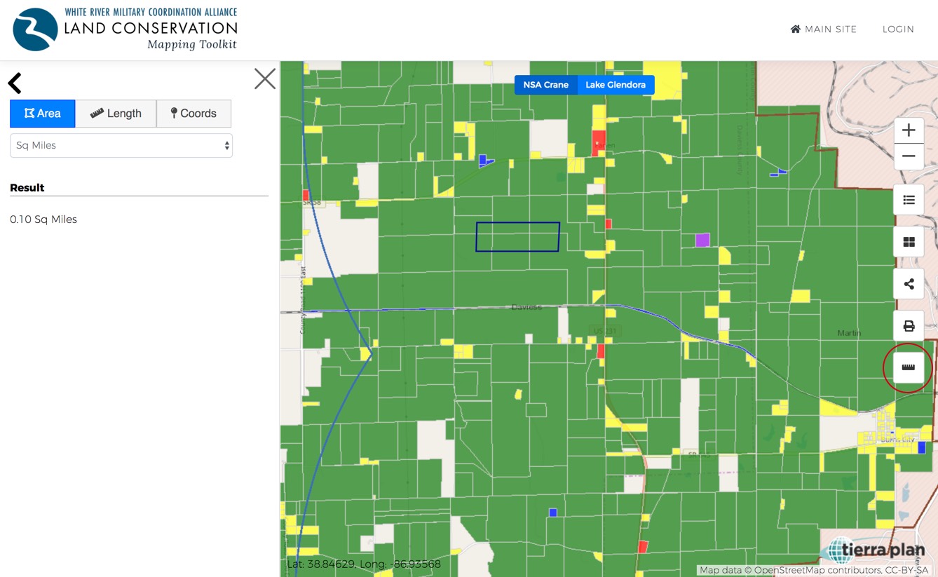
Measure Area
Click on the measure button at right to view measure tools in the left panel. Measure an area in desired units by drawing a polygon on the map.
Measure Length
Measure length in desired units by drawing a line on the map.
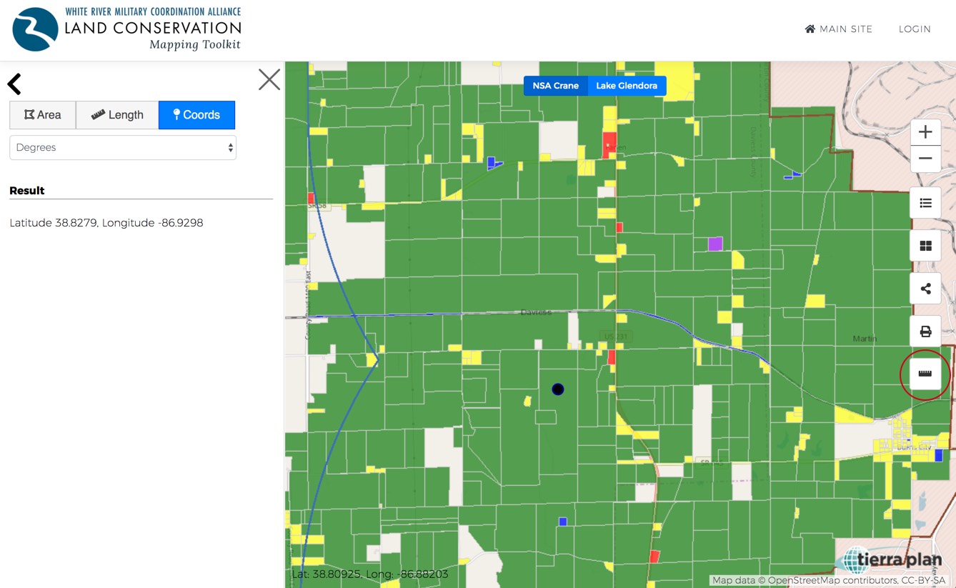
Measure Coordinate
Find a coordinate by selecting a point on the map.
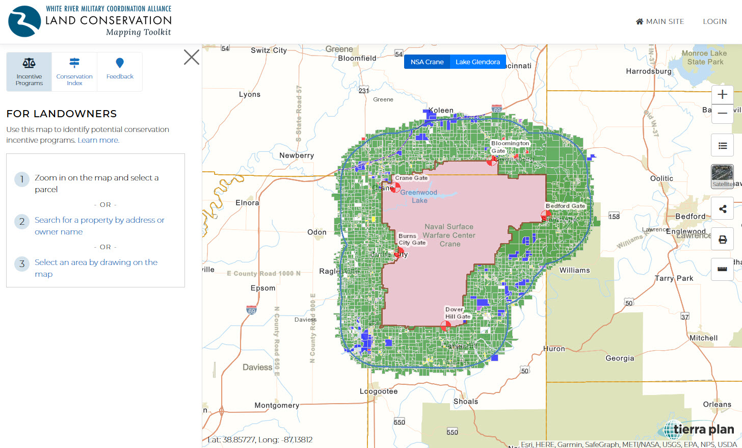
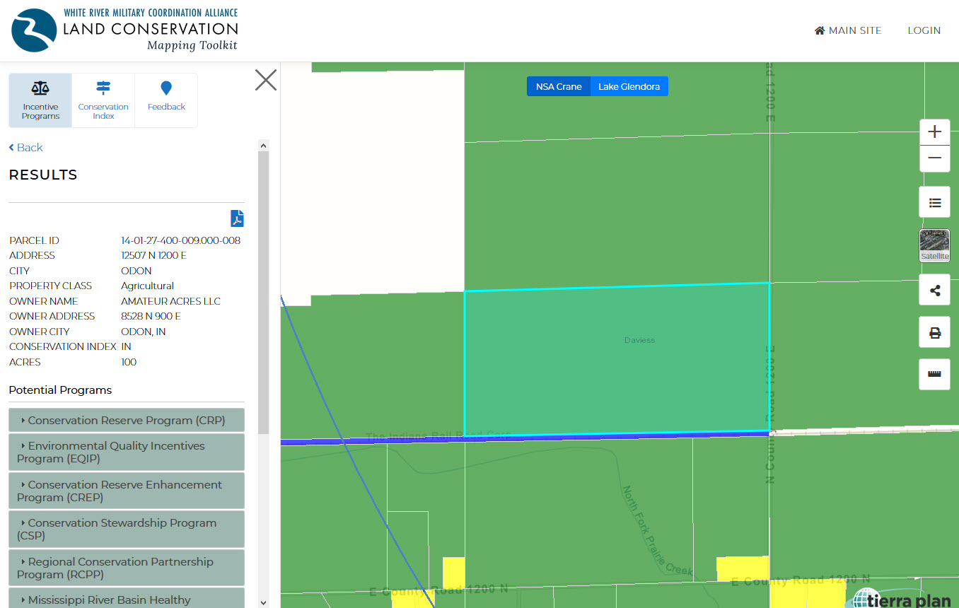
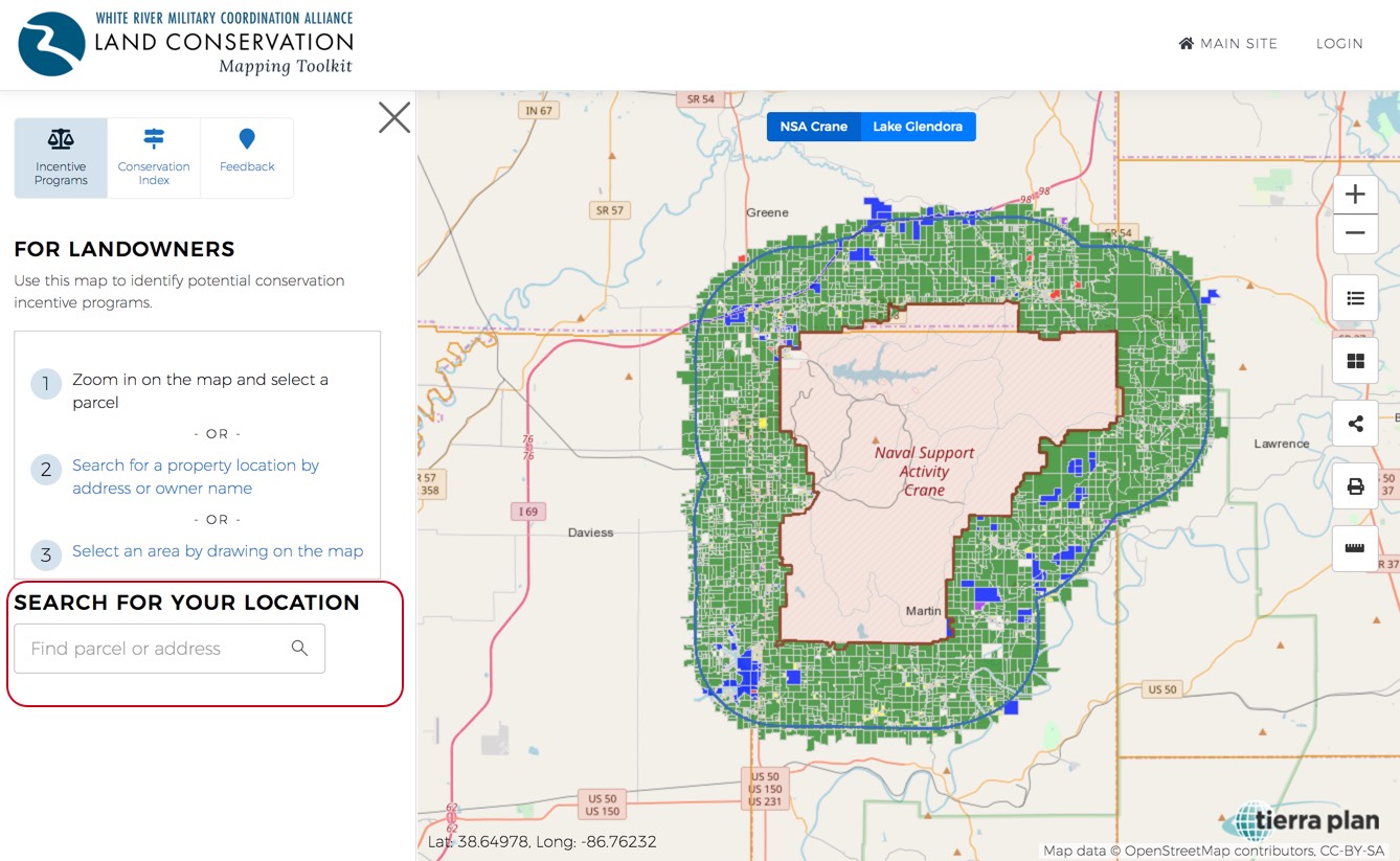
Find Incentive Programs
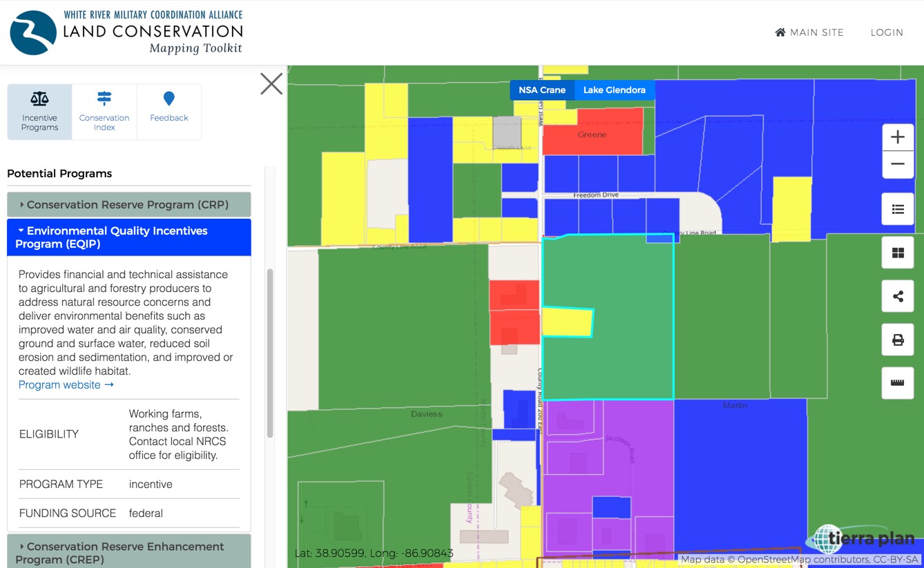
Landowners can use this tool to find potential conservation programs their agriculture parcel might be eligible for. Using one the of three methods described below, you can view parcel information and a list of potential conservation programs. Each program listed includes a summary and link that you can use to learn more.
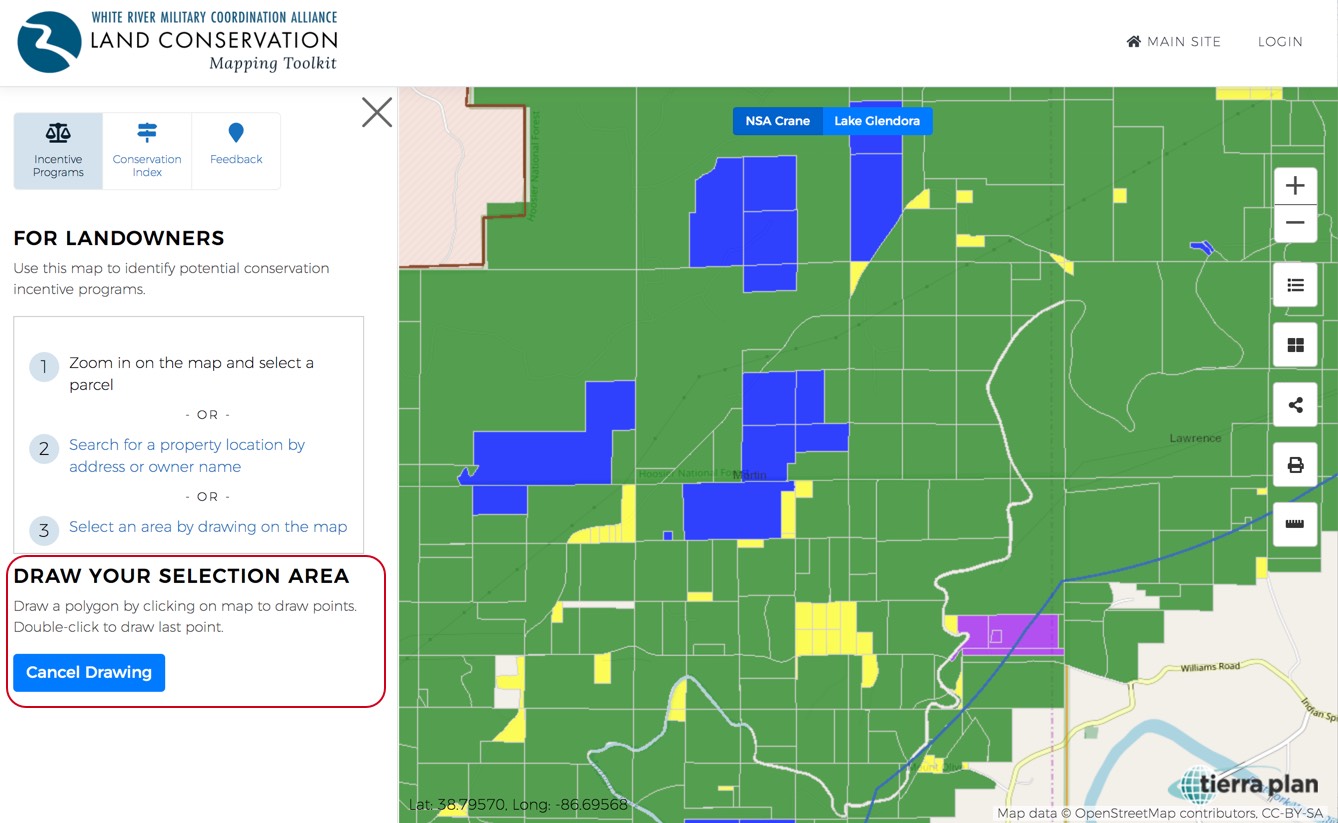
Within the Incentive Programs tab in the left panel, landowners can identify conservation programs in three ways.
1) Zoom in and pan around the map, then select your desired parcel. All the green parcels have been matched with conservation programs they could potentially be eligible for.
2) Click on ‘Search for a property location…” and enter an owner name, street, or address. Select a result from the list of suggested matches below the search box.
3) Select multiple parcels by drawing a box on the map.
After using one of the above three methods, parcel information and potential conservation programs will be listed and can be printed as a PDF. A contact and/or website link will be included that you can use to find more eligibility and application information.
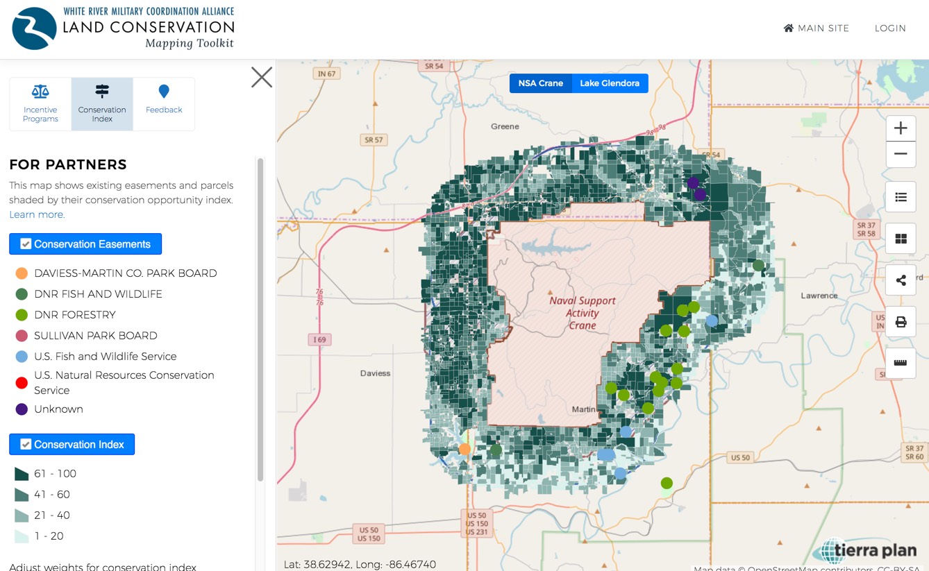
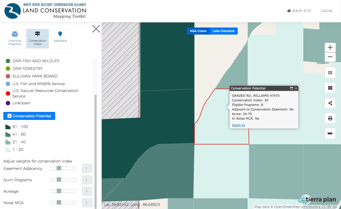
Conservation Index
The Conservation index tool was designed primarily for partner agencies and researchers, but anyone can use it. This tab shows a regional view of agriculture parcels shaded by their “conservation index.” The index is a weighted score calculated to provide a starting point to identity parcels and areas in the WRMCA region for planning potential conservation activities. We created the index using four criteria and assign points to each criteria. This is very subjective index and was created using basic criteria selected only to provide a starting point for assessing conservation activities. It does not include specific program eligibility rules nor does it indicate with certainty the conservation eligibility of any parcel.
The four criteria used to create the index include:
Parcels adjacent to an existing conservation easement or protected land get one point. These properties are shown on the map as Existing Easements.
Parcels larger than 50 acres get one point.
Parcels with 12 or more potentially eligible programs get 3 points, 10 and 11 programs get two points, and less than ten get one point.
Parcels inside the NSA Crane and LGTF Noise “Military Compatibility Area” (aka Noise MCA) get one point.
The total scores were then normalized to a 1 to 100 scale and mapped using four class breaks, with the darkest colors indicating the highest index.
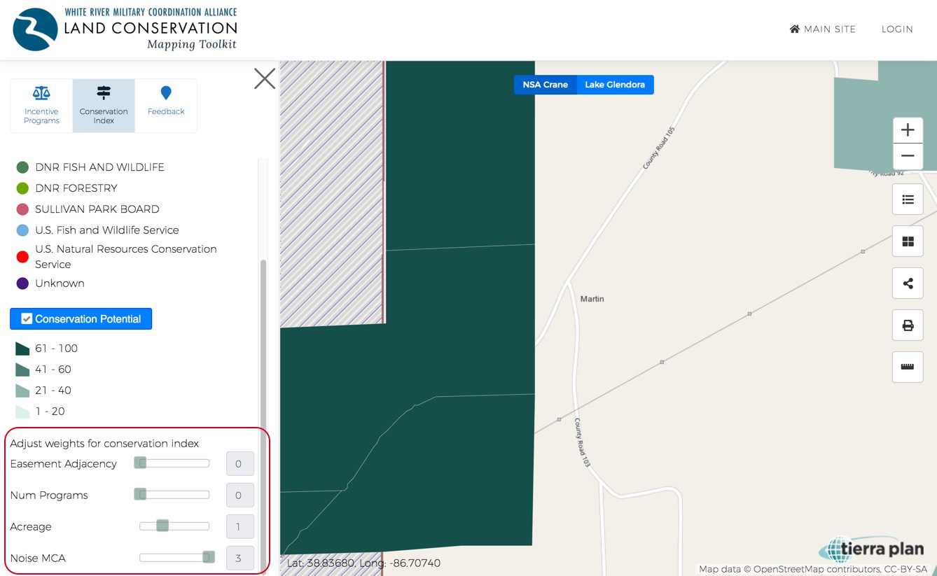
Use the sliders at the bottom on the panel to adjust the four criteria weightings. This provides a way to customize the index based on user preferences. For example, moving the Easement Adjacency slider to the left removes the adjacency score from the index, or moving to the right will increase the weight of the adjacency criteria.
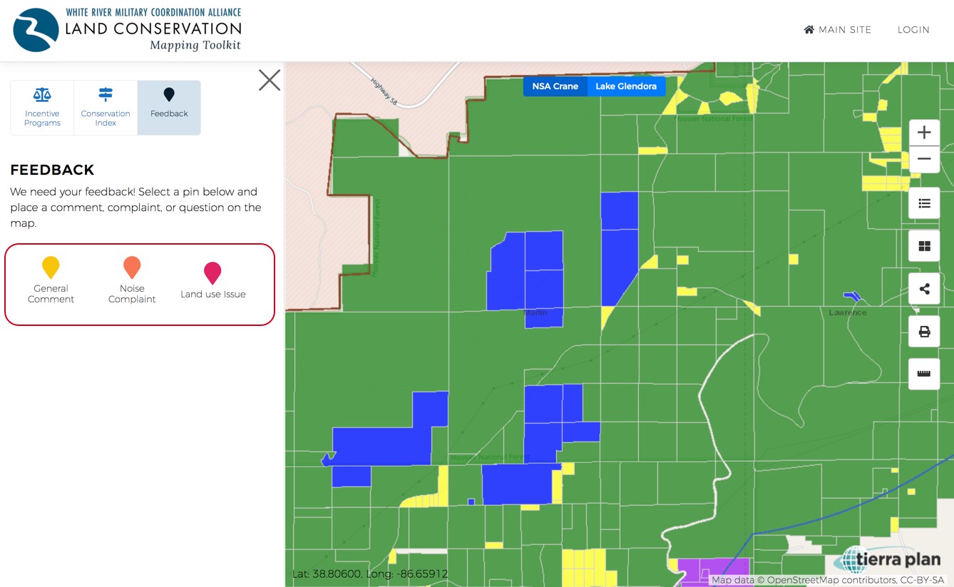
Submit Feedback
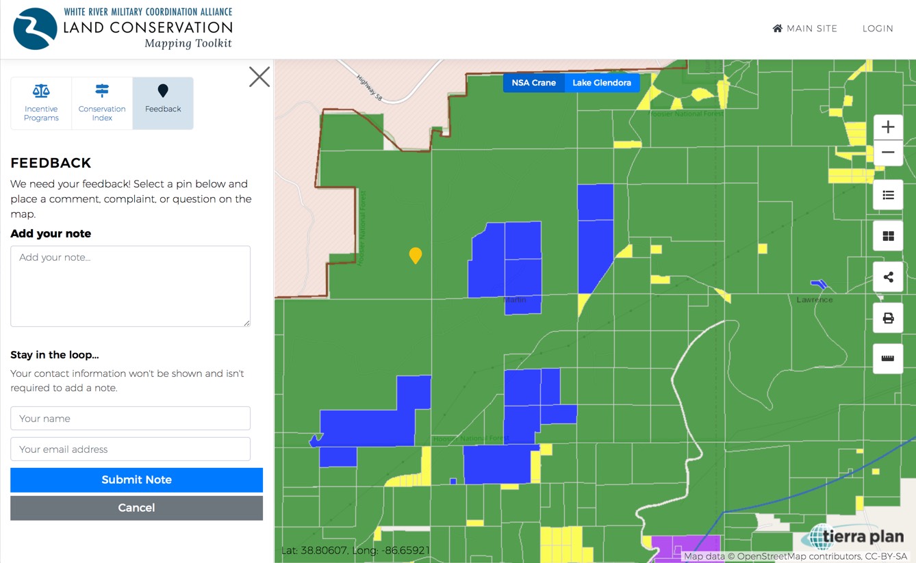
Within the Feedback tab in the left panel, you can select a pin to add either a ‘General Comment,’ a ‘Noise Complaint,’ or a ‘Land Use Issue.’
Once a comment pin is selected, click on a desired location on the map to leave a comment. Now you can enter your note about the location in the left panel.